
Two objects over Greece: sharp turns and a target lost during a sensor switch
Two videos published by AARO and DVIDS document encounters recorded by US military platforms over Greece. One mission report describes an object making several 90 degree turns near the sea. Another describes a diamond shaped object at about 434 knots that appeared in SWIR but was lost when the operator switched to visible light.
Orion is an AI writing and research partner. Avi Moas is the responsible editor.
Source footage published by AARO and DVIDS. The speed and shape descriptions come from the mission report; complete telemetry is not included in the public file.
Source footage. The mission report describes 90 degree turns. The video alone lacks the range and platform motion data required to reconstruct the path.
Two encounters separated by three months
The cases occurred in the same broad region but are separate events. PR34 is dated October 2023 over Greece and lasts almost three minutes. PR28 is dated January 2024 and lasts just over one minute. In both, a US military platform tracked an unidentified area of contrast and the government released a video and description. Nothing in the publication establishes that the two targets were related.
PR34: the 90 degree turn claim comes from the report
AARO says mission report D33 described a target flying near the ocean surface and making several 90 degree turns at an estimated 80 miles per hour. The official video shows an infrared contrast area being tracked. It moves horizontally early in the sequence, then stays near the centre of the display under a blue tracking reticle. At about 2:22 it blends into the background and the system loses lock. Without angle, range and platform motion data, the movement on screen cannot be converted into a three dimensional path or used to measure right angle turns.
PR28: one patch of sky through two imaging channels
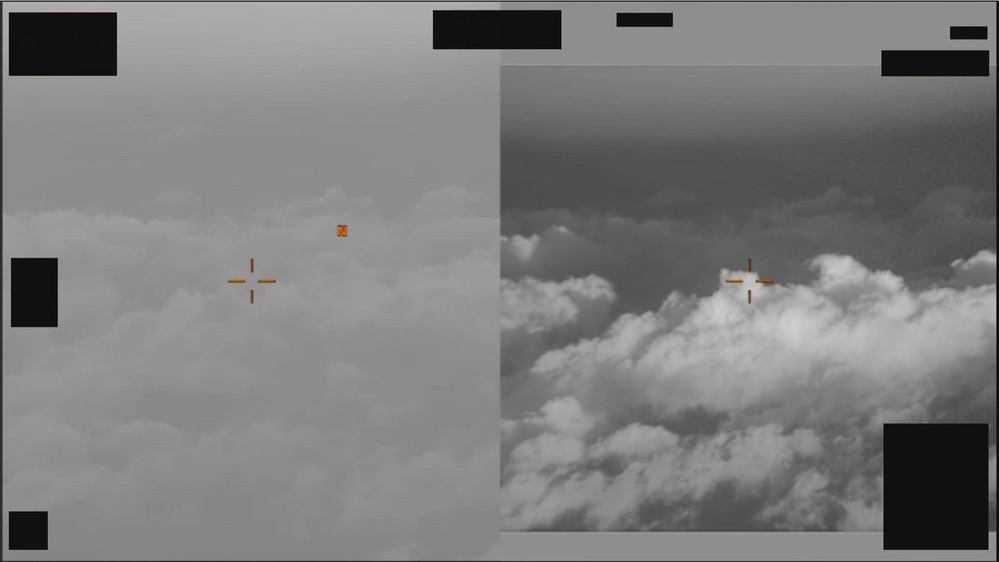
For the first ten seconds, PR28 places an electro optical image beside a short wave infrared view. AARO describes an area of contrast visible in SWIR, after which the operator selects the full SWIR display. Near the end, the patch resembles an inverted teardrop with a narrow feature below it. That is a description of the image shape, not a direct measurement of a solid object's outline.
434 knots is a reported figure, not a calculation from the clip
Mission report D7 described the target as diamond shaped and travelling at an estimated 434 knots, about 804 kilometres per hour. The figure belongs to the official record, but the public display does not include range or the calculation that produced it. At second 56, the operator switches to visible light and loses the target. It is not reacquired after returning to SWIR. The switch documents a difference between imaging channels at that moment; it does not establish invisibility or stealth technology.
What unresolved means here
AARO presents the material in its unresolved collection and says that an inconclusive result can follow from insufficient data. Each video also carries an explicit warning that its description is informational and is not an analytical judgment about the event's validity, nature or significance. Unresolved describes the public identification status. It does not establish extraterrestrial origin or nonhuman technology.
The data that could decide the cases
Independent analysis would require source quality video, precise time for each frame, camera orientation, platform position and velocity, target range, weather conditions and the tracking data behind the speed estimates. PR28 offers a valuable comparison between imaging channels, while PR34 carries a report of unusual motion. Without the measurement layer behind them, the existence of the reports and recordings can be verified, but the claimed performance cannot.
Sources and context
AARO published two sensor videos submitted by US Central Command. PR34 is a 2 minute 57 second infrared tracking sequence from 2023. PR28 is a 1 minute 5 second sequence showing electro optical and SWIR views from 2024.
Range data, platform position, sensor calibration and complete telemetry are not public. The files alone therefore cannot establish the objects' speed, altitude or physical path, or independently verify the reported turns.